 About the Watershed
Description
of Watershed
Interactive Online GIS Map (This may take some time to load. It will load in a new browser window.)
Michigan State University Institute of Water Research Interactive Mapping Program (Understanding Your Watershed) for Michigan Watersheds. (Data available for the Michigan portion of the St. Joseph River Watershed.)
Watershed
Map Images
(click images for more information)
(click images for more information)
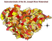 |
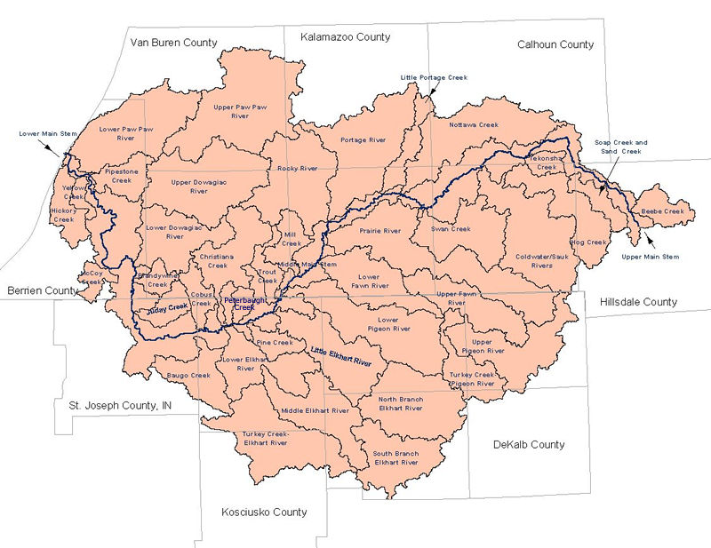
Subwatersheds
of the St. Joe River Watershed. Source: USGS Nat'l Hydrology Dataset.
Major Subwatersheds. |
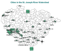 |
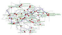
Cities
in the watershed.
|
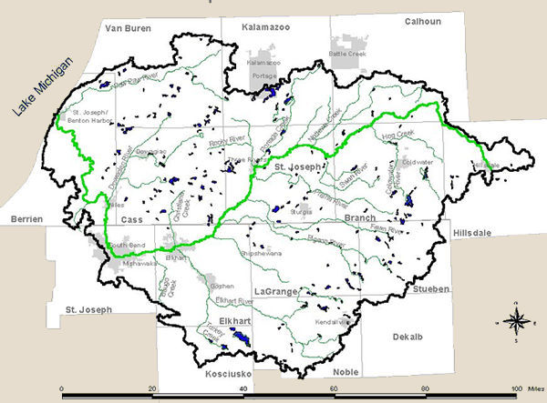 |
Simplified map image. |
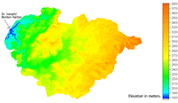 |
Digital Elevations of the Watershed on a 300 meter resolution and subwatershed delineation. |
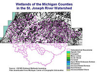 |
Wetlands in the Watershed. Click on the image to view each Michigan county individually and to view Indiana wetland maps. |
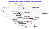 |
Managed Areas (nature preserves, state parks, etc.) |
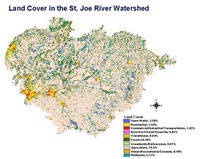 |
1990's Land Use. Watershed is over 70% agriculture. |
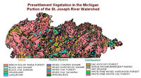 |
Michigan Presettlement Land Cover, circa 1800s. |
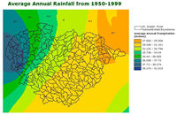 |
Average Annual Precipitation, 1950-1999. |
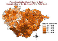 |
Percent Agricultural Land Cover in Each Subwatershed |
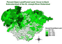 |
Percent Forest and Open Land Cover in Each Subwatershed |
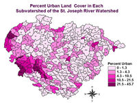 |
Percent Urban Land Cover in Each Subwatershed |
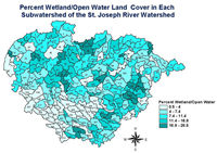 |
Percent Wetland and Open Water Land Cover in Each Subwatershed |
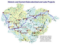 |
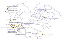
Subwatershed Projects. |
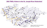 |
The watershed contains 19 impaired water bodies in Indiana and 14 in Michigan, as defined by the Clean Water Act 303(d). |
|
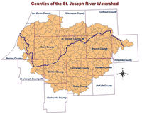
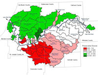
Counties of the Watershed |
|
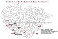
Combined Sewer Overflow Outfalls in the watershed. |
 |
USEPA Enviromapper for Watersheds. Click image to access maps of federally regulated facilities. |
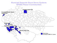 |
Communities regulated by Phase II of the NPDES Program. |
 |
Dams in the watershed. |
 |
Federally regulated facilities in the watershed including NPL, NPDES, RCRA. |
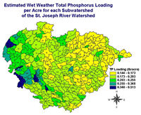 |
Total Phosphorus and Total Suspended Solid Nonpoint Source Loading Model. |
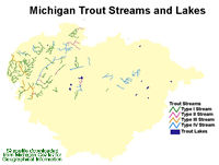 |
Michigan Designated Trout Streams and Lakes. Link to Indiana Trout Stocking Information. |
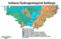 |
Indiana Hydrogeological Settings |
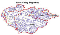 |
River Valley Segments, as defined by the MDNR |
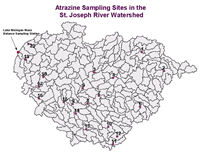 |
Atrazine issues in the Watershed. |
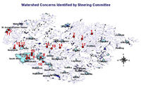 |
Site specific watershed concerns identified by the Steering Committee |
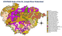 |
Soils of the Watershed |
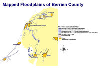 |
Available electronic floodplain maps |
 |
Identification of Critical Areas at the Subwatershed Level |
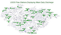 |
United States Geological Survey Water Resources Stations. |
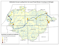 |
Quantification of Road-Stream Crossings in Michigan |