 you
are here » st. joe river homepage
» wmp »
tasks »
task 2 »
average rainfall
you
are here » st. joe river homepage
» wmp »
tasks »
task 2 »
average rainfall
you
are here » st. joe river homepage
» wmp »
tasks »
task 2 »
average rainfall
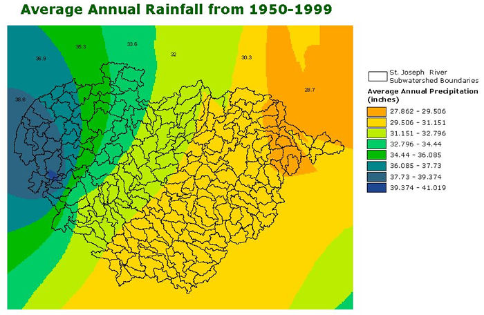
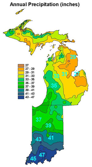
The map below was created from annual rainfall data obtained from the USDA NRCS Geospatial Data Gateway.