 Task
2. Drainage Basin Characterization
Task
2. Drainage Basin Characterization- Interactive Online GIS Map (Developed for this project. This may take some time to load. It will load in a new browser window.)
- Michigan State University Institute of Water Research Interactive Mapping Program (Understanding Your Watershed) for Michigan Watersheds. (Data available for the Michigan portion of the St. Joseph River Watershed.)
- The USDA
NRCS Geospatial Data Gateway offers access to GIS data and enables
users to download shapefiles.
- The USEPA Enviromapper for Water allows users to view watershed information and regulated facilities through online maps.
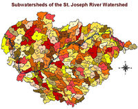 |
Subwatersheds of the St. Joe River Watershed. |
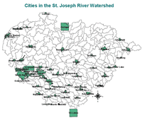 |
Cities in the watershed. |
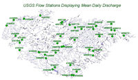 |
United States Geological Survey Water Resources Stations. |
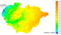 |
Digital Elevations of the Watershed on a 300-meter resolution and subwatershed delineation (using 300- and 30-meter resolution data). |
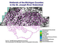 |
Wetlands in the Watershed. Click on the image to view each Michigan county individually and to view Indiana wetland maps. |
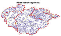 |
River Valley Segments, as defined by the Michigan Department of Natural Resources |
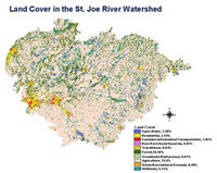 |
1990's Land Use. Watershed is over 70% agriculture. |
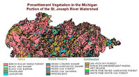 |
Michigan Presettlement Land Cover, circa 1800s. |
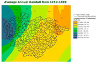 |
Average Annual Precipitation, 1950-1999. |
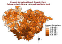 |
Percent Agricultural Land Cover in Each Subwatershed |
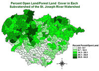 |
Percent Forest and Open Land Cover in Each Subwatershed |
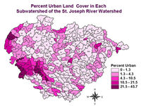 |
Percent Urban Land Cover in Each Subwatershed |
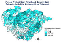 |
Percent Wetland and Open Water Land Cover in Each Subwatershed |
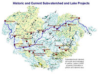 |
Subwatershed Projects in the Watershed. |
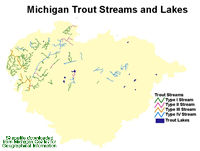 |
Michigan Designated Trout Streams and Lakes. Link to Indiana Trout Stocking Information. | 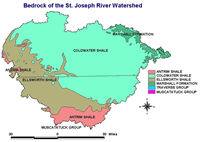 |
Geological Features |
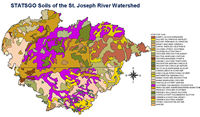 |
Soils of the Watershed | 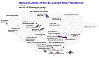 |
Managed Areas (Nature Preserves, State Parks, etc.) |
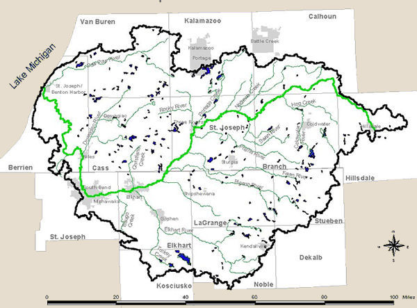 |
Watershed Boundaries | 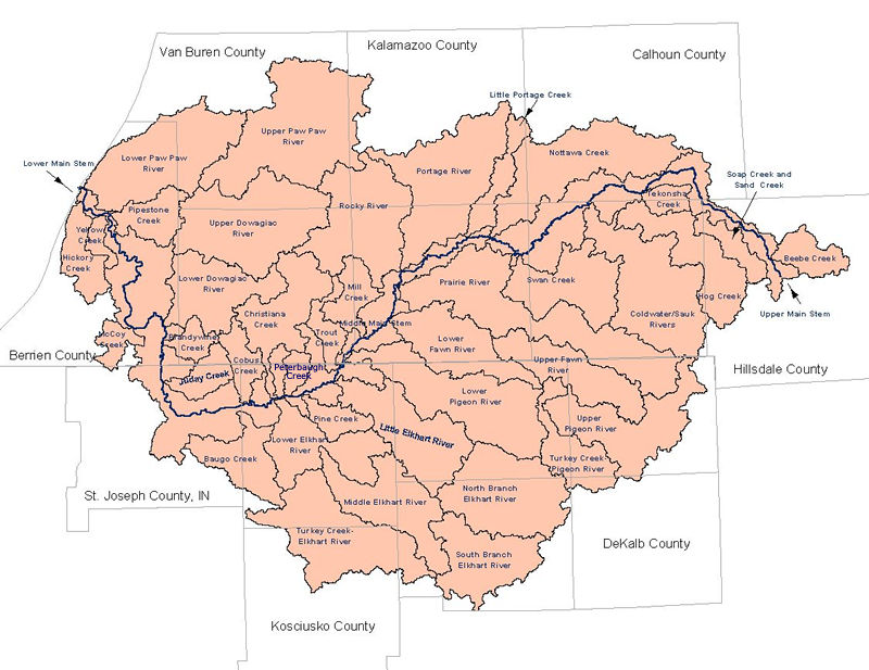 |
Major Subwatersheds |