 you
are here » st. joe river homepage
» wmp »
tasks »
task 2 » subwatersheds
you
are here » st. joe river homepage
» wmp »
tasks »
task 2 » subwatershedsyou
are here » st. joe river homepage
» wmp »
tasks »
task 2 » subwatersheds
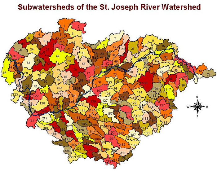
KIESER & ASSOCIATES delineated the above subwatershed boundaries using a
30-meter resolution elevation data.
Print/zoom
in on the above map (PDF file).
Download a table listing the subwatersheds and their HUC codes:
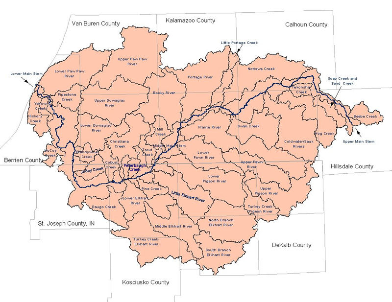
The 217 subwatersheds above were combined into major subwatersheds for the purpose of subwatershed scoring.