 you
are here » st. joe river homepage
» wmp »
tasks »
task 2 » wetlands
you
are here » st. joe river homepage
» wmp »
tasks »
task 2 » wetlandsyou
are here » st. joe river homepage
» wmp »
tasks »
task 2 » wetlands
Go to Indiana Wetland Maps.
Go
to Indiana Wetland Density by County.
Go
to Wetland Density by Subwatershed.
Go to Watershed Mechanisms to Protect Wetlands.
Click on each county
for a more detailed view of the mapped wetlands.
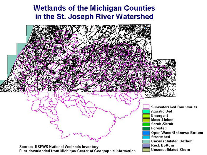
The following table lists acres of Michigan wetlands in the St. Joseph Watershed,
by wetland class.
| Wetland Type | Acres |
| Emergent | 57,590 |
| Forested | 139,399 |
| Unconsolidated Bottom | 53,550 |
| Scrub-Shrub | 34,358 |
| Aquatic Bed | 2,621 |
| Open Water/Unknown Bottom | 562 |
| Total | 288, 440 |
In contrast to
the above table, 1990s land cover data from the USGS National Land Cover Data
Set, indicates that
only 172,000 acres of wetland remain in the entire watershed (6% of watershed);
that's both Indiana and Michigan.
The above figure, 288,440, only includes those St. Joseph River Watershed wetlands
in Michigan.
Michigan presettlement land cover indicates that wetlands covered 14.7% of the
watershed (in Michigan).
These data were produced by the USFWS National
Wetlands Inventory and downloaded from the Michigan
Center for
Geographic Information. They have not been ground truthed and may not acurately
portray local variations.
These data should not be relied upon solely for wetland delineations or permitting.
Indiana Wetlands (Click on the left or right side of the map to zoom in. Cities shown on resulting map.)
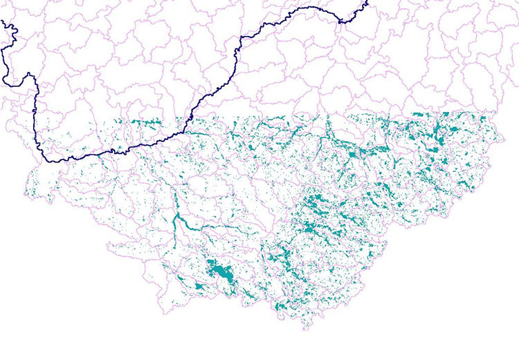
Wetland GIS shapefile
downloaded from the Indiana Geological Survey, and developed by the U.S. Fish
and Wildlife Service
National Wetlands Inventory. The shapefile was clipped by the watershed boundaries.
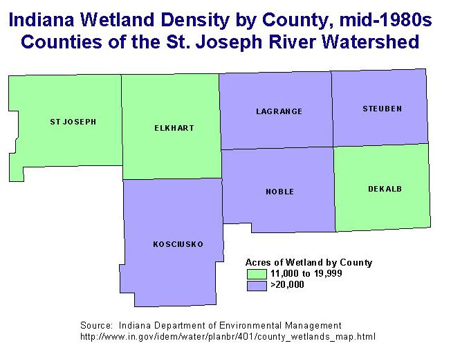
Density
of Wetlands in Indiana Counties in the Watershed. Go to the IDEM website
for a map
of all counties and a table
of wetland acreages by county.