- Atrazine
is the most widely used herbicide in the U.S., primarily in corn production.
- Atrazine
has a mild solubility and low Henry's Law constant, which makes it very
susceptible to leaching by runoff.
- Atrazine
is applied in the field late April through May.
- Atrazine
degradation is slow in the water (only 0.8% per year in Lake Michigan).
- Lake Michigan
LaMP 2000 listed atrazine, a possible carcinogen, as an "Emerging Pollutant".
- Lake Michigan
LaMP 2002 continues to put atrazine on its "Watch List".
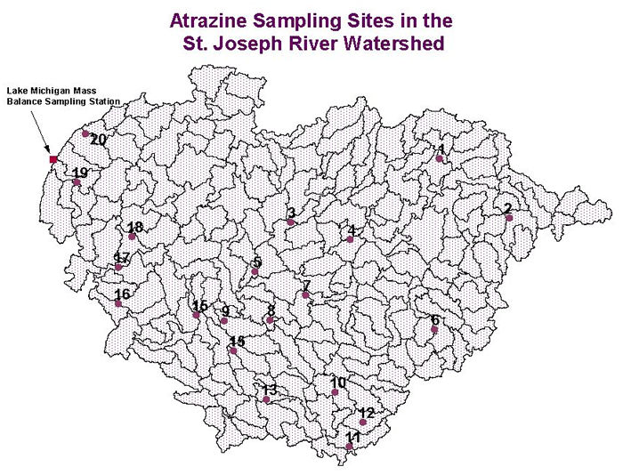
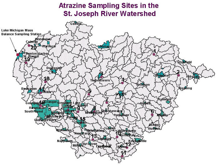
- The Lake
Michigan Mass Balance (LMMB) study, lead by EPA in 1994-1995, estimated
that the St. Joseph River Watershed is the largest atrazine contributor
to Lake Michigan at 602 kg/yr. However, (1) this estimate needs to be
updated; (2) more monitoring data are needed to support the estimate
(only 11 data points at the mouth of the St. Joe were collected in 1995
for the estimate), and; (3) no sub-basin level estimates are available.
- The LMMB
study, when modeling atrazine for Lake Michigan, used a "removal rate"
(% of land application atrazine transported to the lake) approach to
estimate tributary contributions. These removal rates were obtained
from the literature were not calibrated in the St. Joe River Basin.
- In the
LMMB study, EPA also indicated that more analysis at the watershed level
is required.
- A USDA-ERS
research report pointed out that the most cost-effective strategy to
control atrazine leaching to surface and ground waters is to target
atrazine management restrictions and alternatives (including partial
atrazine ban, runoff control BMPs, and crop management, etc.) to meet
water quality standards. This strategy requires the identification of
those watersheds with atrazine water quality problems and hydrological
conditions best suited for these management restrictions and alternatives.
- The USGS,
with funding from the State of Michigan, is conducting a study to look
into the transport
of atrazine in groundwater .
|
 you
are here » st. joe river homepage
» wmp »
tasks
»
task 4 » atrazine
you
are here » st. joe river homepage
» wmp »
tasks
»
task 4 » atrazine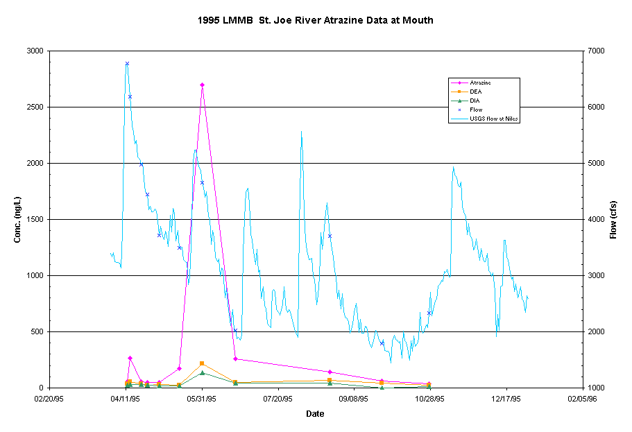 Click
chart for a larger view.
Click
chart for a larger view.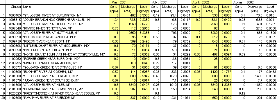